Huayhuash
85 km Distance
5050 m Elevation gain
8 days Duration
Advanced Difficulty

Recommended
May - September but it can be done all year round
Ideal for
Experienced hikers with good acclimatisation and mountain self-sufficiency.
Access
Bus, shared minibus, taxi, tour or private car.How to get there
From Huaraz
Travel by road towards Chiquián and continue to Llamac, a traditional access point to the Huayhuash circuit.
5h30
Approximately, passing villages, rural communities and high-Andean landscapes.
From Llamac
At the end of the circuit, return by road towards Chiquián to connect back to Huaraz.
5h30
The schedule depends on local transport and road conditions.

Description
Huayhuash is a remote mountain range between Áncash, Huánuco and Lima, more compact than its neighbour, the Cordillera Blanca, but also more technical and further from villages and roads.
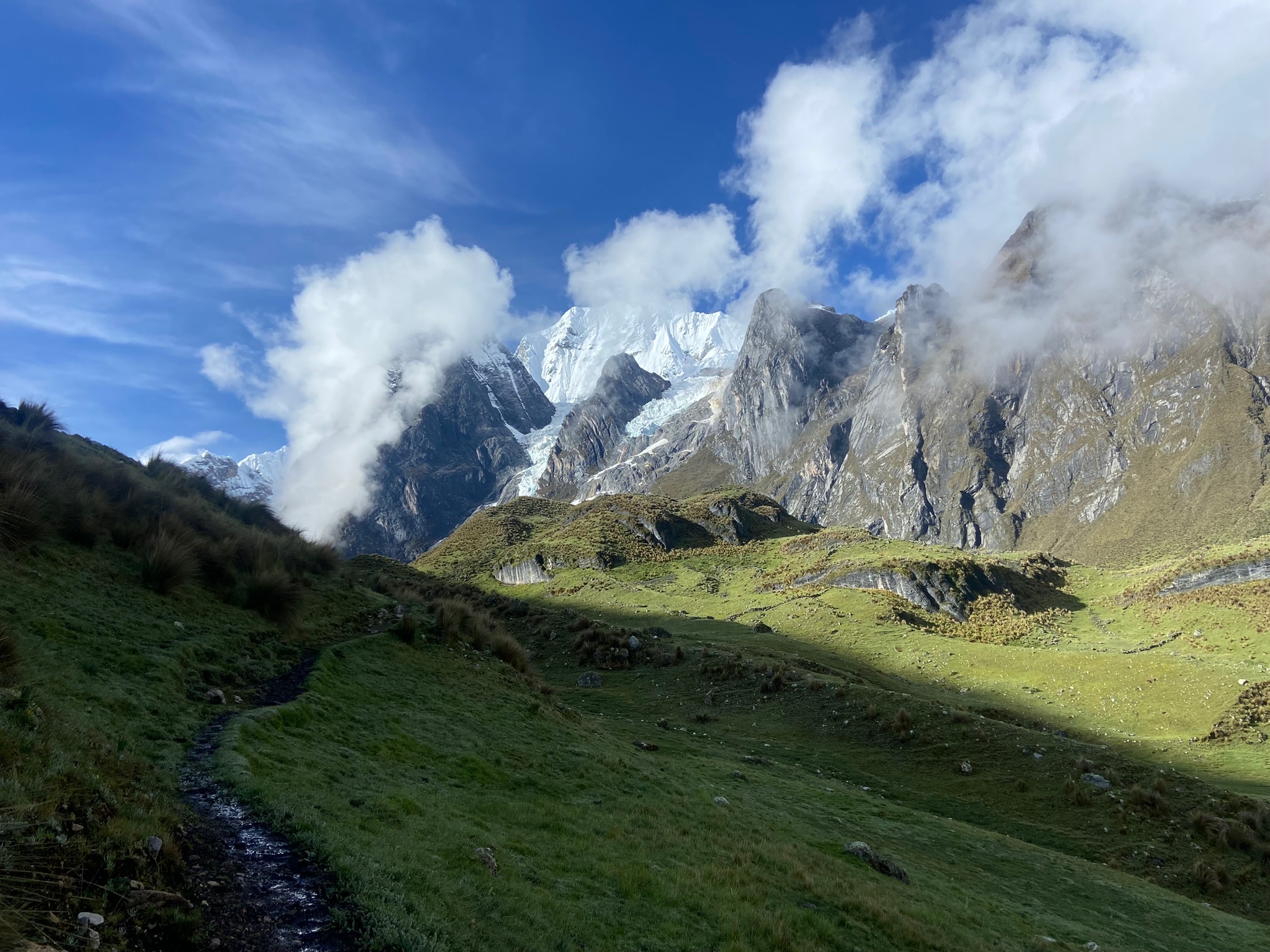
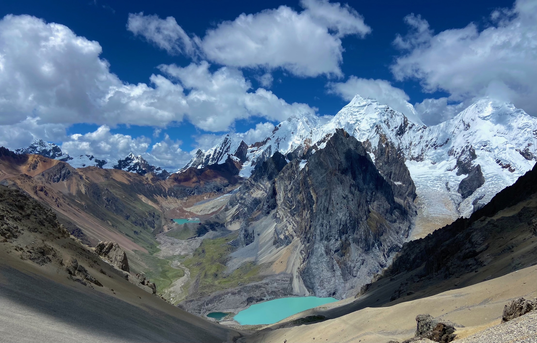
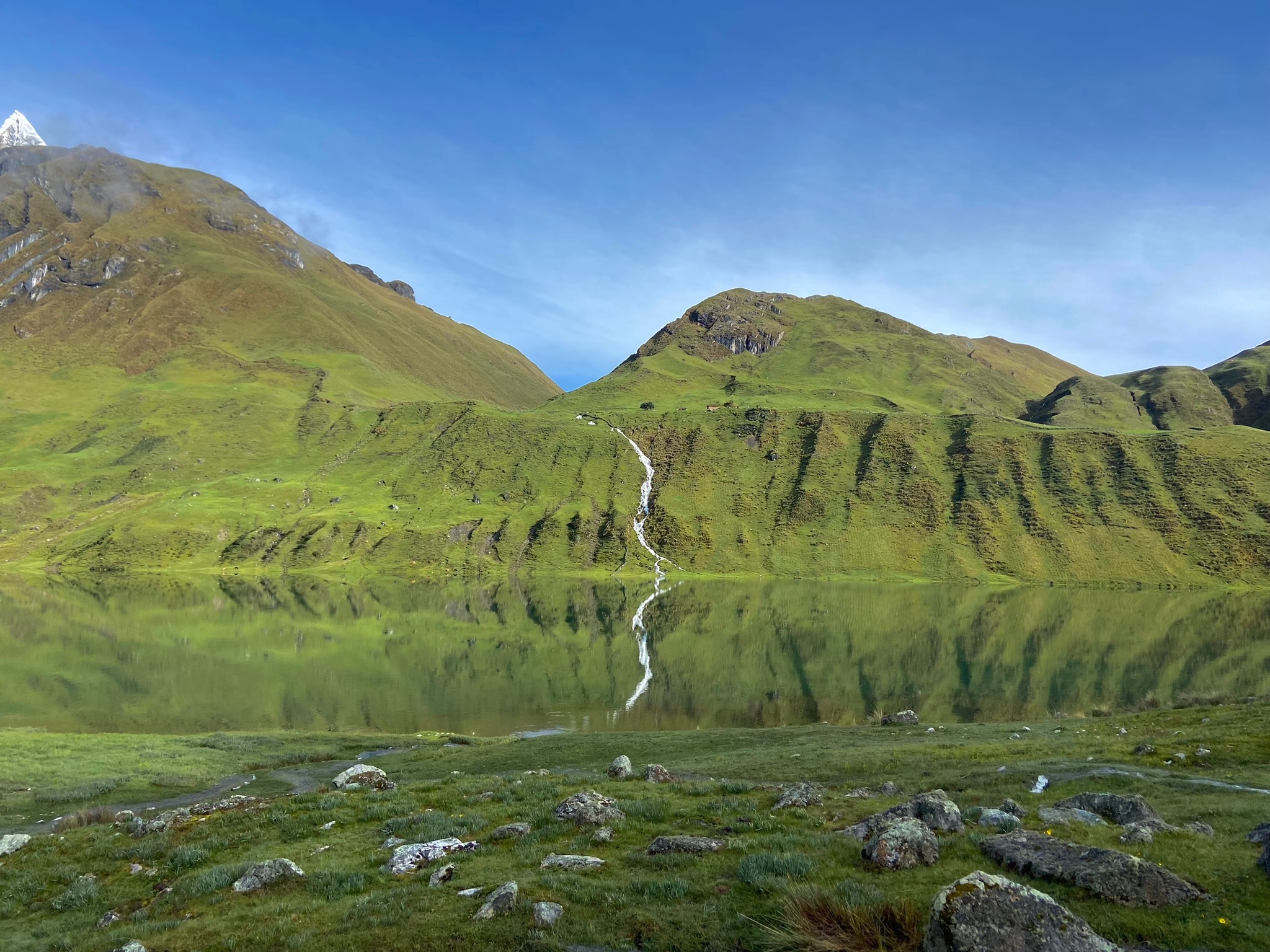
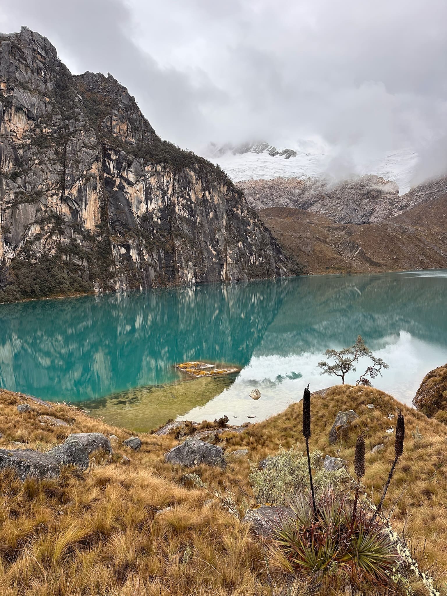
The Huayhuash circuit is known as one of the most beautiful treks in the world. It is a true maze of mountains, with sharp peaks, pyramids of ice and rock, crystal-clear glacial lakes and passes where the mountains seem close enough to touch. One of its great advantages is its many alternatives, including an alpine route, so you can fully adapt it to your preferences, ability and available time.
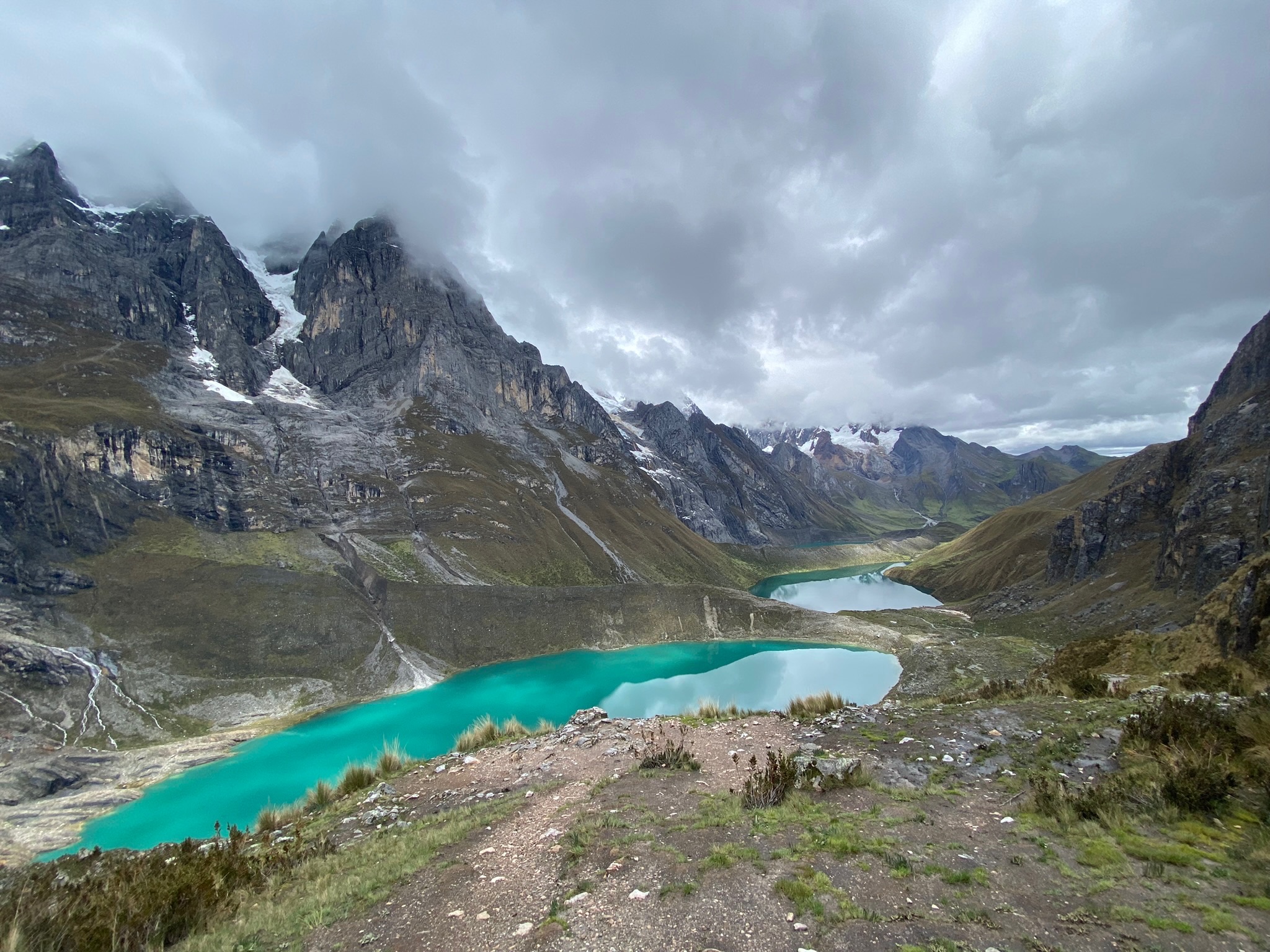
There are several entry and exit points, making the route quite flexible. Itineraries can range from 4 to 15 days. The circuit is managed by local communities, which charge between 20 and 40 soles per person for camping. Its most iconic highlights include Tres Lagunas (Siula, Quesillococha and Gangrajanca), the imposing mountains Siula Grande—famous for the story of Tocando el Vacío—and Yerupajá, as well as spectacular passes such as Trapecio and San Antonio.
Sample itinerary (8 days)
Day 01: Quartelhuain – Paso Cacananpunta (4690 m) – Janca / Mitococha (4220 m)
10 km | +520 m | 5hThe hike climbs gradually, passing a cave on the left before reaching paso Cacananpunta, the gateway to the cordillera Huayhuash. This point reveals the first broad view of the range. The descent leads to the Janca (or Mitococha) campsite, facing the imposing Jirishanca, Rondoy and Ninashanca, which dominate the horizon.
Day 02: Janca / Mitococha (4220 m) – Paso Carhuac (4630 m) – Laguna Carhuacocha (4150 m)
10 km | +400 m | 6hThe trail climbs gently to Paso Carhuac, an excellent natural viewpoint towards Jirishanca, Rondoy and Ninashanca. From there, it descends towards laguna Carhuacocha, considered one of the circuit's most spectacular campsites. Facing Yerupajá, Perú's second-highest mountain, and Jirishanca, their imposing walls are reflected in the lake's waters on days with little wind.
Day 03: Carhuacocha (4150 m) – Mirador Tres Lagunas – Paso Siula (4830 m) – Huayhuash (4350 m)
14 km | +690 m | 8hOne of the most iconic days of the trip, with the climb to the famous Tres Lagunas viewpoint. There is the option of a detour to laguna Cancrjanca, the first of the three, to appreciate the intense turquoise colour of its waters and surrounding rock walls up close.
The route continues climbing to Paso Siula. Although the final stretch is steep, the reward is open views of Huayhuash's main peaks. From there, the descent skirts laguna Carnicero before reaching the Huayhuash campsite, whose Quechua name refers to the Andean weasel found in the area and gives the entire range its name.
Day 04: Huayhuash (4350 m) – Paso Trapecio (5010 m) – Pampa Cuyoc / Elefante (4490 m)
11 km | +910 m | 7hThe day begins with the climb to Paso Trapecio, one of the circuit's highest points. As you gain height, the landscape becomes increasingly open. Alternatively, you can approach the glacier for a closer view of the ice and the surrounding mountains.
From the pass, the trail descends gradually towards Pampa Cuyoc or Elefante, where camp is set up.
Day 05: Elefante / Pampa Cuyoc (4490 m) – Huayllapa (3490 m)
19 km | +565 m | 9hThe trail climbs to Paso San Antonio, one of the most spectacular viewpoints on the entire hike. From here, there is an unforgettable view of peaks such as Carnicero, Sarapo, Rasac and Yerupajá, which completely dominate the landscape.
After crossing the pass, a long descent through the valley leads to Huayllapa, one of the few villages on the route. Here, you can restock supplies and even spend the night in accommodation before continuing the hike.
Day 06: Huayllapa (3490 m) – Gashpampa (4520 m)
12 km | +1310 m | 7hThe route leaves Huayllapa behind, following the river through a broad valley that gradually narrows between mountains. As you gain height, Juitush, Huacsha, Tapush and Diablo Mudo come into view, until you reach Paso Tapush Punta (4770 m), one of the finest natural viewpoints in this part of the range. From the pass, a short descent leads to the Gashpampa campsite, which is usually colder because of its higher elevation.
For those seeking an additional challenge, Diablo Mudo (5350 m) can be climbed with mountaineering equipment.
Day 07: Gashpampa (4520 m) – Jahuacocha (4050 m)
9.5 km | +503 m | 5h30The trail climbs to Paso Yaucha (4900 m), from where there are two alternatives for descending towards the iconic laguna Jahuacocha. The route on the left, along the ridge, is more demanding but offers even more impressive views.
The panorama takes in lagunas Solterococha and Jahuacocha below, with mountains of different colours that seem painted in oils. The final descent leads to the lakeside campsite, one of Huayhuash's most iconic places.
Day 08: Jahuacocha – Paso Cruz Punta (3620 m) – Llamac – Huaraz
9.5 km | +503 m | 5h30On the eight-day itinerary, this is the final stage of the hike. Leaving early is advisable to reach Llamac around 11:00 and catch transport back to Huaraz. The trail descends gently through the valley until it reaches the turn-off to Llamac, marking the final stretch of the route.
For those wishing to include Viconga (Gunog) and paso San Antonio, one possible adaptation would be: Day 05: Viconga — Jurau; Day 06: Jurau — Huatiac; Day 07: Huatiac — Jahuacocha; Day 08: Jahuacocha — Llamac.

Map

Trails can change. Follow the map attentively and with care.
Similar options
 Advanced



 Advanced
 Advanced
 Advanced
 Advanced